Back to results Spacious Vacant House with Land in Mima City, Tokushima

Needs Verification

This listing hasn't been verified recently. Tap to request a priority check!

Know someone who would love this? Gift them a subscription

¥800,000

Naro, Mima-cho, Mima City, Tokushima Prefecture

徳島県美馬市美馬町字ナロヲ

Sign in to save properties

Work with our partners to help you search, evaluate, and purchase property in Japan.

Book a Consultation
Buy Farmhouse Renovation Project House Akiya Bank Rice Field Large Garden Needs Renovation Rural

Unlock the full description with a free trial

Includes AI translation, hazard data, cost estimates & nearby amenities

3 days free · cancel anytime

Start Free Trial

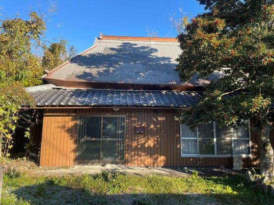
An Expansive Property with Potential in Mima City, Tokushima

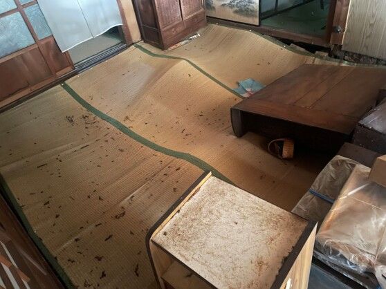
Critical agent notes provide essential context. The listing states: "Other: 3 minutes by car to the post office (2km)." More importantly, the remarks section reveals: "Adjacent farmland (1,824 sqm, currently a mixed forest) included. This property is recommended for large-scale renovation or demolition. Please note that to receive information on this property, registration with the 'Mima City Akiya Bank' is required." This indicates the property comes with a significant additional plot and is a fixer-upper project, necessitating official registration with the local vacant house bank for inquiries.

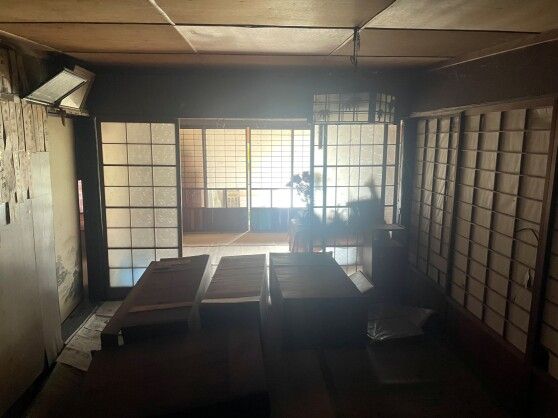
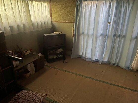
The property is equipped with public water supply, town gas, and propane. It features a dedicated bath and toilet, though the drainage system is a septic tank (night soil) type. The kitchen uses gas, and the gas water heater has been removed. Parking is available, with space for approximately 1 to 2 cars. The nearest major transport link is the JR Tokushima Line's Awa-Handa Station, about a 4km walk, and the Mima Interchange is a 4-minute drive (2km) away.

Mima City, located in western Tokushima on Shikoku Island, boasts a relatively warm Seto Inland Sea climate. The area is renowned for its rich natural beauty and numerous cultural assets, offering historic and scenic landscapes. The Yoshino River flows east-west through the heart of the city, with plains along its banks forming the main habitable areas. Approximately 80% of the city's total area is forested mountainous terrain, including the Awa-San Mountains to the north and Mount Tsurugi to the south, creating a region surrounded by clear water and lush greenery. A notable nearby landmark is the majestic Mount Tsurugi, the second-highest peak in western Japan, which offers breathtaking hiking and is deeply woven into the region's cultural and spiritual heritage.

This description was AI-generated from the original Japanese listing and may contain inaccuracies. Please verify details with the source listing.

Summary

Bedrooms: 4
Parking: 1
Land size: 902 / 9,709sqft
House size: 62 / 667sqft

Short-Term Rental (Minpaku)

Transport

KIX

Kansai International Airport — 109 km away

Nearby Konbini

Mini Stop Mini Stop — 3 min walk

Internet Connectivity

Natural Hazard Assessment

Flood Risk Low Risk
Landslide Risk Moderate
Tsunami Risk Low Risk
Earthquake Hazard Moderate

Unlock hazard data with a free trial

Flood, landslide, tsunami & earthquake risk for this property

3 days free · cancel anytime

Start Free Trial

Purchase Cost & Tax Estimates

Agent fees, acquisition tax, registration costs & annual property tax

Airbnb Revenue Estimate

Projected nightly rate, occupancy & net income for this property

Investment ROI

Annual yield, break-even timeline & 10-year return projection

Map & Street View

Map loading...

Location Accuracy Notice: Although we try to make the map accurate with coordinates or address details provided, the location data is provided by the agent. This map data should be used as reference for the surrounding area foremost.

Location Type Beds Price Land House View

* Sold properties shown for price comparison only. Prices reflect historical sale data.

Location Type Beds Rent/Month Land House View

* Rental prices shown are monthly rates. Contact property owner for current availability.