Back to results Free Land in Inami, Wakayama – 1116m² Villa Area Plot
New Today

Know someone who would love this? Gift them a subscription

Price on Request

Wakayama Prefecture, Hidaka District, Inami Town, Oaza Tsui, Aza Yanagigaya 566-95 and others

和歌山県日高郡印南町大字津井字柳ヶ谷566番95 他

Sign in to save properties

Buy Land Rural Quiet Area

Unlock the full description with a free trial

Includes AI translation, hazard data, cost estimates & nearby amenities

3 days free · cancel anytime

Start Free Trial

Free Land in Inami Town, Wakayama Prefecture

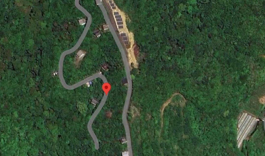
This is a free (0 yen) transfer of four parcels of land located within the Tsuisato Villa area in Inami Town, Hidaka District, Wakayama Prefecture. The property is approximately a 7-minute drive from JR Kisei Main Line's Inami Station and about a 6-minute drive from the Hanwa Expressway's Inami IC. The land is currently in a forested state (mountain forest).

The property is not managed by a management company, so there are no management fees. The annual fixed asset tax is 9,500 yen. Nearby landmarks include the direct-sales market 'Kaeru no Minato' (Frog Port), which sells locally sourced produce and specialty goods, and the 'Kaeru-bashi' (Frog Bridge), a symbol of Inami Town.

Please be aware that the seller will not conduct on-site tours; applicants must inspect the property themselves. The total land area is 1116.00 square meters (approx. 337.59 tsubo) according to the registry. The land category is mountain forest, and the rights are freehold ownership. The fixed asset tax assessment value is 972,912 yen.

This description was AI-generated from the original Japanese listing and may contain inaccuracies. Please verify details with the source listing.

Summary

Land size: 1,116 / 12,013sqft

Short-Term Rental (Minpaku)

Transport

KIX

Kansai International Airport — 68 km away

Nearby Konbini

Lawson Lawson — 30 min walk

Internet Connectivity

Natural Hazard Assessment

Flood Risk Low Risk
Landslide Risk Moderate
Tsunami Risk Low Risk
Earthquake Hazard Moderate

Unlock hazard data with a free trial

Flood, landslide, tsunami & earthquake risk for this property

3 days free · cancel anytime

Start Free Trial

Purchase Cost & Tax Estimates

Agent fees, acquisition tax, registration costs & annual property tax

Map & Street View

Map loading...

Location Accuracy Notice: Although we try to make the map accurate with coordinates or address details provided, the location data is provided by the agent. This map data should be used as reference for the surrounding area foremost.

Location Type Beds Price Land House View

* Sold properties shown for price comparison only. Prices reflect historical sale data.

Location Type Beds Rent/Month Land House View

* Rental prices shown are monthly rates. Contact property owner for current availability.