Back to results Large Development Land Plot in Rikuzentakata - 5,973m²

Verified Listing

This property was checked recently and confirmed to still be available. Tap for details.

Verified Listing

This property has been verified in the last month. Our system regularly checks listings to ensure they are still available.

Last verified: April 17, 2026

Know someone who would love this? Gift them a subscription

Negotiable

Takata-cho Oishi, Rikuzentakata City, Iwate Prefecture

岩手県 陸前高田市 高田町字大石

Sign in to save properties

Rent Land Waterfront Quiet Area

Unlock the full description with a free trial

Includes AI translation, hazard data, cost estimates & nearby amenities

3 days free · cancel anytime

Start Free Trial

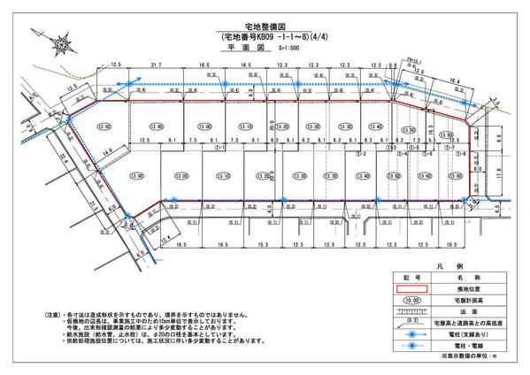
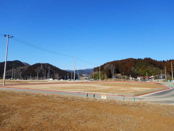
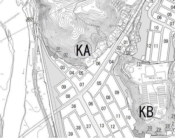
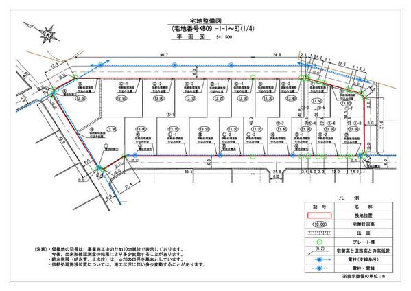
Located in Takata-cho, Rikuzentakata City, this expansive 5,973 square meter plot of land presents an excellent development opportunity in a revitalizing area. The property is currently designated as temporary replotting land as part of an ongoing land readjustment project, specifically identified as KB09 block 1-1 through 1-8.

Situated in a Type 1 residential zone with a building coverage ratio of 60% and floor area ratio of 200%, this vacant lot offers flexible development potential. The property benefits from its proximity to the Rikuzentakata Station on the JR Ofunato Line (BRT), providing convenient transportation links.

The area has undergone significant redevelopment since the 2011 tsunami, with improved flood defenses and elevated land levels. The nearby Miracle Pine Tree and Takata-Matsubara Road Station have become notable landmarks, creating new vibrancy in the district. The property is available for both purchase and lease, making it suitable for various development scenarios.

This description was AI-generated from the original Japanese listing and may contain inaccuracies. Please verify details with the source listing.

Summary

Land size: 5,973 / 64,293sqft

Short-Term Rental (Minpaku)

Transport

NRT

Narita International Airport — 377 km away

Nearby Konbini

Family Mart Family Mart — 16 min walk

Internet Connectivity

Natural Hazard Assessment

Flood Risk Low Risk
Landslide Risk Moderate
Tsunami Risk Low Risk
Earthquake Hazard Moderate

Unlock hazard data with a free trial

Flood, landslide, tsunami & earthquake risk for this property

3 days free · cancel anytime

Start Free Trial

Purchase Cost & Tax Estimates

Agent fees, acquisition tax, registration costs & annual property tax

Map & Street View

Map loading...

Location Accuracy Notice: Although we try to make the map accurate with coordinates or address details provided, the location data is provided by the agent. This map data should be used as reference for the surrounding area foremost.

Location Type Beds Price Land House View

* Sold properties shown for price comparison only. Prices reflect historical sale data.

Location Type Beds Rent/Month Land House View

* Rental prices shown are monthly rates. Contact property owner for current availability.