Back to results Land for Sale in Tamano, Okayama - 486.75 sqm Vacant Plot

Needs Verification

This listing hasn't been verified recently. Tap to request a priority check!

Know someone who would love this? Gift them a subscription

¥1,000,000

Nishi-Taiji 1670, Tamano City, Okayama Prefecture

岡山県玉野市西田井地1670

Sign in to save properties

Buy Farmhouse Land Rural

Unlock the full description with a free trial

Includes AI translation, hazard data, cost estimates & nearby amenities

3 days free · cancel anytime

Start Free Trial

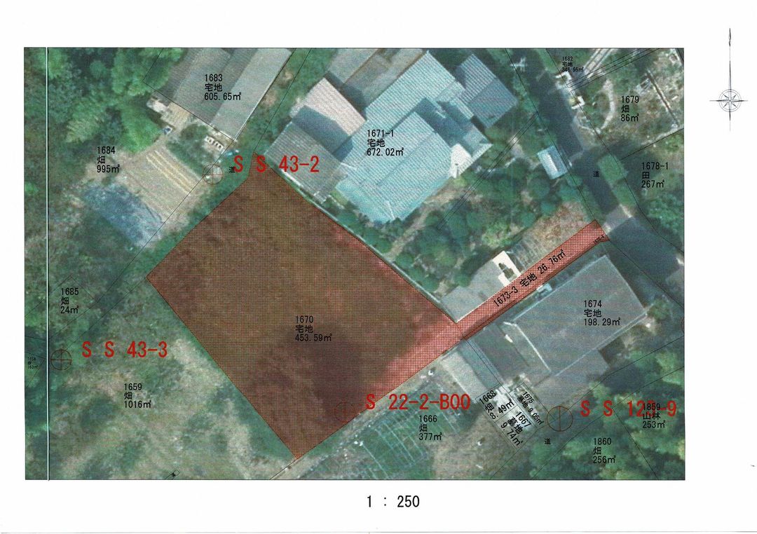
Flat Land Parcel in Tamano City, Okayama Prefecture

This 486.75 square meter (approximately 147.24 tsubo) plot of land is available for purchase in the Nishi-Taiji area of Tamano City, Okayama Prefecture. The land is currently vacant and level, making it an ideal canvas for agricultural use such as a field or for use as a storage area for materials. The property is noted as being accessible by light vehicles, enhancing its utility for such purposes.

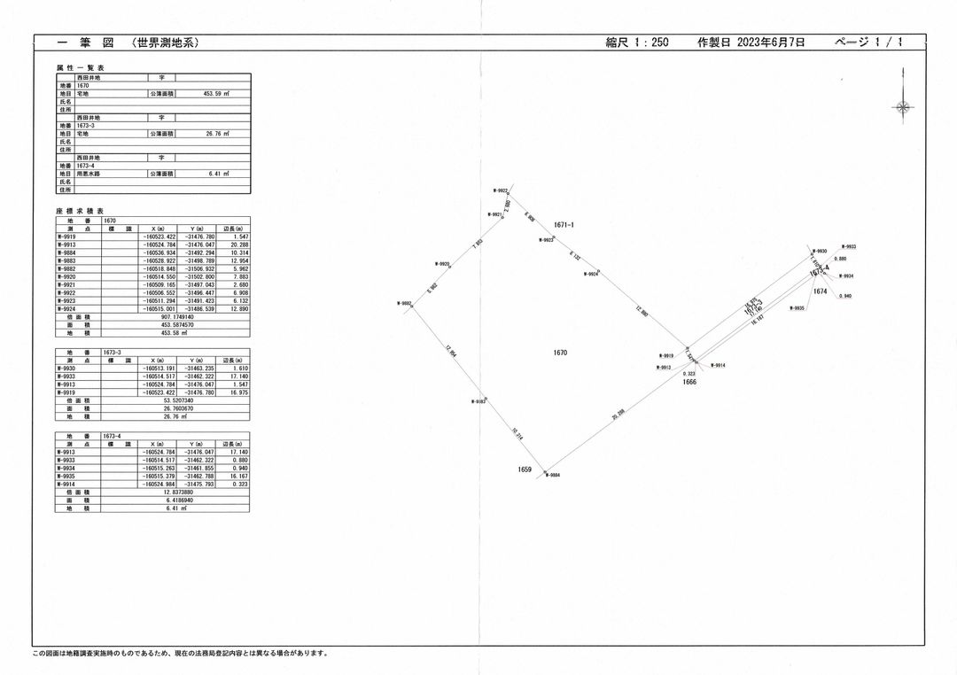
Critical agent notes specify the road access details: the property fronts a single public road to the northeast. This road has a width of 2.6 meters, with the property's frontage measuring 1.9 meters, and the road surface is paved. The land is designated as residential land (宅地) but is located within a City Planning Area of Adjustment (市街化調整区域), with no specific use district assigned. Importantly, the property comes with a significant note: construction of buildings is not permitted (建築不可). The transaction will be based on the registered area (公簿取引) and the land will be transferred in its current condition (現況渡し). The land shape is described as flagpole-like (旗竿状).

The area of Tamano City offers a relaxed coastal lifestyle within Okayama Prefecture. An interesting local fact is that Tamano is home to the Seto Ohashi Bridge, one of the world's longest two-tiered bridge systems, connecting Honshu to Shikoku. The closest major tourist attraction is the scenic Setonaikai National Park, renowned for its beautiful islands and calm inland sea, perfect for cycling, hiking, and enjoying panoramic views.

This description was AI-generated from the original Japanese listing and may contain inaccuracies. Please verify details with the source listing.

Summary

Land size: 487 / 5,239sqft

Short-Term Rental (Minpaku)

Transport

KIX

Kansai International Airport — 116 km away

Nearest Konbini

circle_k Circle K — 11 min walk

Internet Connectivity

Natural Hazard Assessment

Flood Risk Low Risk
Landslide Risk Moderate
Tsunami Risk Low Risk
Earthquake Hazard Moderate

Unlock hazard data with a free trial

Flood, landslide, tsunami & earthquake risk for this property

3 days free · cancel anytime

Start Free Trial

Purchase Cost & Tax Estimates

Agent fees, acquisition tax, registration costs & annual property tax

Airbnb Revenue Estimate

Projected nightly rate, occupancy & net income for this property

Investment ROI

Annual yield, break-even timeline & 10-year return projection

Map & Street View

Map loading...

Location Accuracy Notice: Although we try to make the map accurate with coordinates or address details provided, the location data is provided by the agent. This map data should be used as reference for the surrounding area foremost.

Location Type Beds Price Land House View

* Sold properties shown for price comparison only. Prices reflect historical sale data.

Location Type Beds Rent/Month Land House View

* Rental prices shown are monthly rates. Contact property owner for current availability.