Land for Sale in Saitama City's Urawa Ward
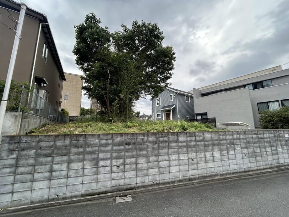
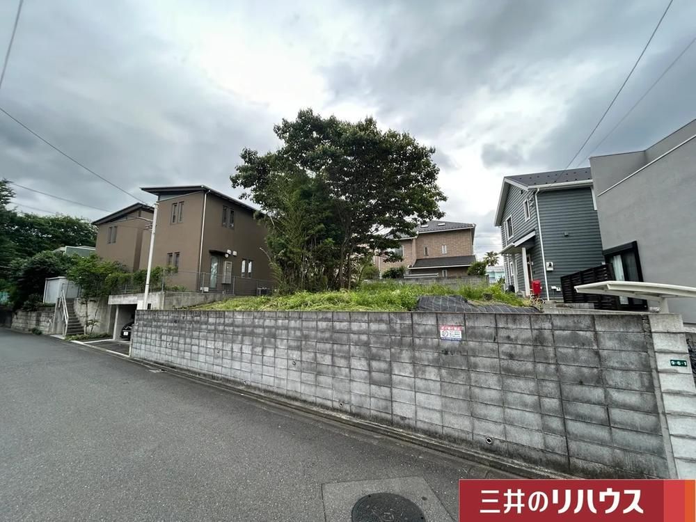
This is a vacant land parcel located in the Maechi 1-chome area of Urawa Ward, Saitama City, Saitama Prefecture. The property is being sold by Mitsui no Rehouse Urawa Center, a division of Mitsui Fudosan Realty Co., Ltd. The land is offered as a straightforward sale with no building conditions attached, allowing the buyer the freedom to choose their preferred home builder or construction company.
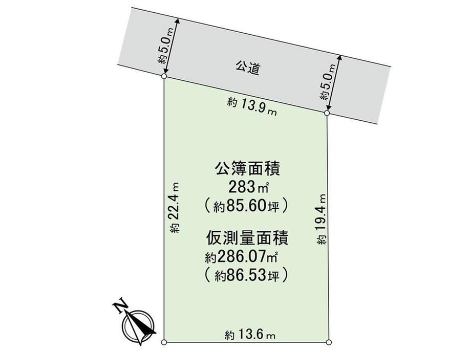
The site has a registered land area of 283 square meters (approximately 85.6 tsubo). The current status of the land is cleared and vacant. The property faces a north-east side public road with a width of approximately 5 meters, and the frontage measures about 13.9 meters. The surrounding area is already developed with existing buildings, enabling planning that takes into account the neighborhood context. The land is situated in a quiet residential area.
Access to public transportation is convenient, with Urawa Station on the JR Keihin-Tohoku/Negishi, Tohoku Main, and Takasaki lines being an 11-minute walk away. Minami-Urawa Station on the same Keihin-Tohoku line is a 14-minute walk. The surrounding neighborhood offers several amenities, including a Lawson convenience store (5 minutes on foot), a Maruetsu Petit supermarket (8 minutes on foot), and a Yaoko supermarket (10 minutes on foot). Urawa Parco shopping center is a 9-minute walk, and Isetan Urawa store is a 14-minute walk away.
Key specifications include a building coverage ratio of 60% and a floor area ratio of 200%. The land rights are freehold. The property is designated under Category 1 Residential zoning. There are additional regulations including Cultural Property Protection Law restrictions and quasi-fire prevention area designation. The current land category is listed as forest. It is important to note that public water supply, main sewer, and city gas have not yet been connected to the site, and connection costs will be an additional expense. The site plan is based on a provisional survey drawing and is not a final drawing; the final surveyed area may change after boundary confirmations with neighboring properties are completed.