Back to results Leased Land Plot in Namie Town, Fukushima - 1,451 sqm

Needs Verification

This listing hasn't been verified recently. Tap to request a priority check!

Leased Land Plot in Namie Town, Fukushima - 1,451 sqm

Know someone who would love this? Gift them a subscription

¥110,000 per month

Yatsuta, Inarimae, Namie Town, Futaba District, Fukushima Prefecture

福島県双葉郡浪江町大字谷津田字稲荷前

Sign in to save properties

Rent Near Station Land Akiya Bank Corner Lot

Unlock the full description with a free trial

Includes AI translation, hazard data, cost estimates & nearby amenities

3 days free · cancel anytime

Start Free Trial

Vacant Land Plot in Namie Town, Fukushima Prefecture

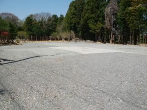
This listing is for a substantial vacant land plot located in the Yatsuta district of Namie Town, Fukushima Prefecture. The property is a cleared, level plot of land with a total area of 1,451.73 square meters (approximately 439.14 tsubo), offering significant space for development. It is situated in a corner lot position and is available for immediate handover. The land is fully serviced with essential utilities including water supply, sewerage, electricity, and city gas, making it ready for construction. The monthly land lease price is set at 110,000 yen.

According to the agent's remarks, the property's location provides access to several local amenities. Key distances from the site are: Namie Elementary School (3.5km), Namie Town Hall (4.2km), Namie Junior High School (3km), Namie Clinic (4.3km), Joroku Park (2.3km), Futaba Police Station Namie Branch Office (3.8km), Namie Fire Station (4.1km), and Namie Kindergarten (3.5km). The nearest major transport link is JR Joban Line's Namie Station, accessible by car in approximately 3.1 kilometers.

This description was AI-generated from the original Japanese listing and may contain inaccuracies. Please verify details with the source listing.

Summary

Land size: 1,452 / 15,626sqft

Short-Term Rental (Minpaku)

Transport

NRT

Narita International Airport — 196 km away

Nearest Konbini

lawson Lawson — 108 min walk

Internet Connectivity

Natural Hazard Assessment

Flood Risk Low Risk
Landslide Risk Moderate
Tsunami Risk Low Risk
Earthquake Hazard Moderate

Unlock hazard data with a free trial

Flood, landslide, tsunami & earthquake risk for this property

3 days free · cancel anytime

Start Free Trial

Purchase Cost & Tax Estimates

Agent fees, acquisition tax, registration costs & annual property tax

Map & Street View

Map loading...

Location Accuracy Notice: Although we try to make the map accurate with coordinates or address details provided, the location data is provided by the agent. This map data should be used as reference for the surrounding area foremost.

Location Type Beds Price Land House View

* Sold properties shown for price comparison only. Prices reflect historical sale data.

Location Type Beds Rent/Month Land House View

* Rental prices shown are monthly rates. Contact property owner for current availability.