Back to results Land for Sale in Narutaki, Ukyo Ward, Kyoto - 575.96 sqm

Verified Listing

This property was checked recently and confirmed to still be available. Tap for details.

Verified Listing

This property has been verified in the last month. Our system regularly checks listings to ensure they are still available.

Last verified: April 17, 2026

Know someone who would love this? Gift them a subscription

¥52,400,000

Narutaki Otoyamacho, Ukyo Ward, Kyoto City, Kyoto Prefecture

京都府京都市右京区鳴滝音戸山町

Sign in to save properties

Buy Land Rural Historic

Unlock the full description with a free trial

Includes AI translation, hazard data, cost estimates & nearby amenities

3 days free · cancel anytime

Start Free Trial

Land for Sale in Narutaki, Ukyo Ward, Kyoto

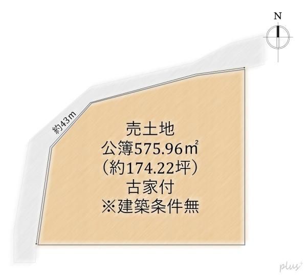
This property is a plot of land for sale in the Narutaki Otoyamacho area of Ukyo Ward, Kyoto. The land has a total area of 575.96 square meters (approximately 174.22 tsubo). The site is situated within a designated urbanization area, zoned as a Category I Low-Rise Exclusive Residential District, with a building-to-land ratio of 30% and a floor area ratio of 60%. There are no specific building conditions attached to the sale.

The current status of the property includes an existing old house. The agent notes that interested parties are encouraged to inquire freely about arranging a viewing at their preferred date and time. The land has road frontage on two sides: 3.4 meters to the north and 3.8 meters to the west. Access to public transport is convenient, with Narutaki Station on the Keifuku Electric Railway Kitano Line approximately a 9-minute walk away, and JR Sanin Main Line's Uzumasa Station about a 19-minute walk.

Important remarks from the agent provide critical details. The property is located within a height control district, a scenic district, and is subject to the Cultural Properties Protection Law. It is also within a regulated land readjustment construction area and has an existing building agreement. The land is divided into two lots: Lot 1 (4-77) is 252 square meters of forested land, and Lot 2 (4-78) is 323.96 square meters of residential land. A provisional survey document exists showing a past total area of 610.55 square meters. The seller plans to conduct a survey before the handover. The seller's liability for non-conformities in the contract is exempted. Furthermore, there is an elevation difference of approximately 2 meters within the plot.

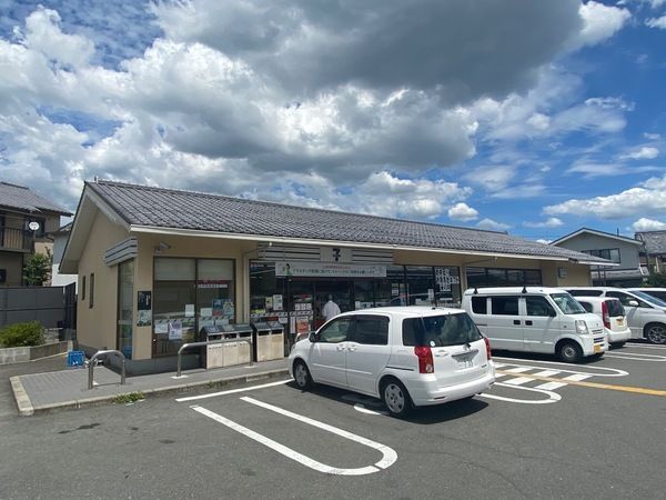
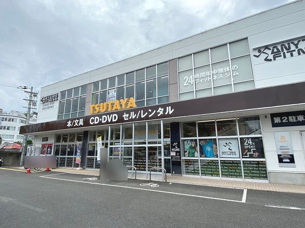
The surrounding neighborhood offers daily amenities, including supermarkets, convenience stores, a drugstore, a bank, a post office, and a kindergarten, all within walking distance.

This description was AI-generated from the original Japanese listing and may contain inaccuracies. Please verify details with the source listing.

Summary

Land size: 576 / 6,200sqft

Short-Term Rental (Minpaku)

Transport

ITM

Osaka International Airport — 36 km away

Nearby Konbini

Seven Eleven Seven Eleven — 9 min walk

Internet Connectivity

Natural Hazard Assessment

Flood Risk Low Risk
Landslide Risk Moderate
Tsunami Risk Low Risk
Earthquake Hazard Moderate

Unlock hazard data with a free trial

Flood, landslide, tsunami & earthquake risk for this property

3 days free · cancel anytime

Start Free Trial

Purchase Cost & Tax Estimates

Agent fees, acquisition tax, registration costs & annual property tax

Airbnb Revenue Estimate

Projected nightly rate, occupancy & net income for this property

Investment ROI

Annual yield, break-even timeline & 10-year return projection

Map & Street View

Map loading...

Location Accuracy Notice: Although we try to make the map accurate with coordinates or address details provided, the location data is provided by the agent. This map data should be used as reference for the surrounding area foremost.

Location Type Beds Price Land House View

* Sold properties shown for price comparison only. Prices reflect historical sale data.

Location Type Beds Rent/Month Land House View

* Rental prices shown are monthly rates. Contact property owner for current availability.