Back to results 146.15 sqm Residential Land for Sale in Setagaya, Tokyo

Needs Verification

This listing hasn't been verified recently. Tap to request a priority check!

Know someone who would love this? Gift them a subscription

¥99,800,000

3-chome, Kita-Karasuyama, Setagaya Ward, Tokyo

東京都世田谷区北烏山3丁目

Sign in to save properties

Buy Near Station Land Gas Heating/Cooking Suburban

Unlock the full description with a free trial

Includes AI translation, hazard data, cost estimates & nearby amenities

3 days free · cancel anytime

Start Free Trial

Prime Residential Land in Setagaya's North Karasuyama

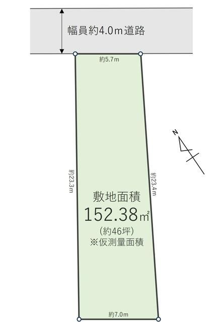
This residential land plot, located in the desirable Setagaya Ward of Tokyo, offers a rare opportunity to build your dream home in a well-established neighborhood. The property spans 146.15 square meters (approximately 44.21 tsubo), providing ample space for a comfortable family residence. Its flat topography simplifies construction and landscaping plans.

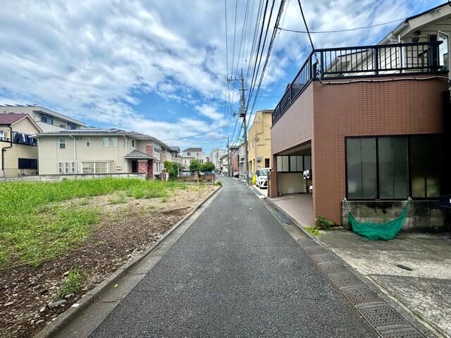
The land is equipped with all essential urban utilities: city gas, water supply, sewerage, and electricity are readily available, ensuring a smooth connection for any new build. Critical access details are noted: the property fronts a 4-meter wide private road to the north, with a frontage of 5.7 meters. It is important to note that there is no 'Position Designation' (位置指定無), which is a specific administrative approval for building roads; this is a point for potential buyers to verify with local authorities regarding building requirements.

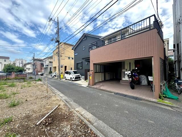
Zoned under the First Category Medium-to-High-Rise Exclusive Residential District, the area promotes a quiet, residential atmosphere with controlled building density. The plot has a building-to-land ratio of 60% and a floor area ratio of 160%. The current status includes an old house, indicating the land is suitable for redevelopment, and terms are open for discussion.

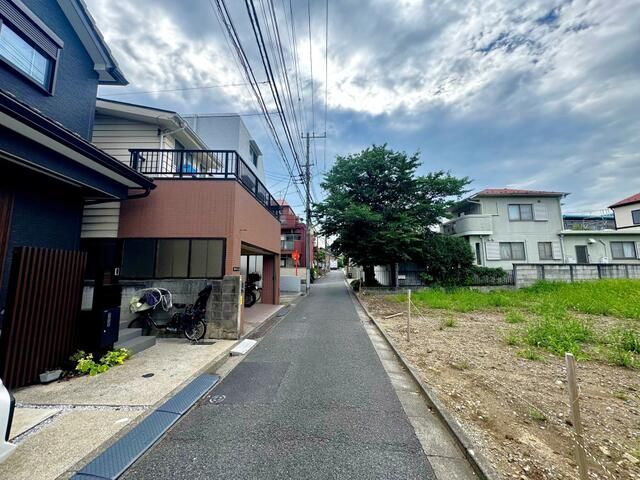
The North Karasuyama area is part of Setagaya, known for its residential charm and greenery. An interesting local fact is that the nearby Kanda River, which flows through the ward, was historically a vital water source and transportation route during the Edo period. The closest major landmark is the majestic Mount Takao, a popular hiking destination and natural park offering stunning views of the Kanto Plain, accessible via the Keio Line from nearby stations.

This description was AI-generated from the original Japanese listing and may contain inaccuracies. Please verify details with the source listing.

Summary

Land size: 146 / 1,573sqft

Short-Term Rental (Minpaku)

Transport

HND

Haneda Airport — 21 km away

Nearest Konbini

family_mart Family Mart — 2 min walk

Internet Connectivity

Natural Hazard Assessment

Flood Risk Low Risk
Landslide Risk Moderate
Tsunami Risk Low Risk
Earthquake Hazard Moderate

Unlock hazard data with a free trial

Flood, landslide, tsunami & earthquake risk for this property

3 days free · cancel anytime

Start Free Trial

Purchase Cost & Tax Estimates

Agent fees, acquisition tax, registration costs & annual property tax

Airbnb Revenue Estimate

Projected nightly rate, occupancy & net income for this property

Investment ROI

Annual yield, break-even timeline & 10-year return projection

Map & Street View

Map loading...

Location Accuracy Notice: Although we try to make the map accurate with coordinates or address details provided, the location data is provided by the agent. This map data should be used as reference for the surrounding area foremost.

Location Type Beds Price Land House View

* Sold properties shown for price comparison only. Prices reflect historical sale data.

Location Type Beds Rent/Month Land House View

* Rental prices shown are monthly rates. Contact property owner for current availability.