Back to results Land for Sale in Kita Ward, Kyoto - 123.1 sqm Plot

Verified Listing

This property was checked recently and confirmed to still be available. Tap for details.

Verified Listing

This property has been verified in the last month. Our system regularly checks listings to ensure they are still available.

Last verified: April 19, 2026

Know someone who would love this? Gift them a subscription

¥34,800,000

Nishirendaino-cho, Kita Ward, Kyoto City, Kyoto Prefecture

京都府京都市北区紫野西蓮台野町

Sign in to save properties

Buy Land Rural Suburban Quiet Area

Unlock the full description with a free trial

Includes AI translation, hazard data, cost estimates & nearby amenities

3 days free · cancel anytime

Start Free Trial

Land for Sale in Kyoto's Kita Ward

This plot of land is located in the Nishirendaino-cho neighborhood of Kyoto's Kita Ward. The property is situated in a flat area and has public water supply, city gas, and sewer infrastructure available. It is within a residential development and construction regulation zone and falls under the northern area of the Yamaroku-type building landscape district.

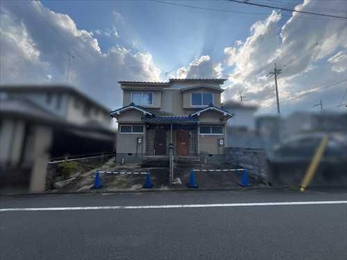
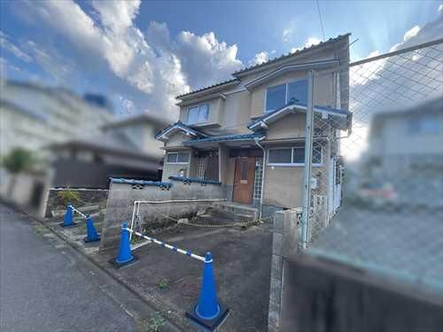
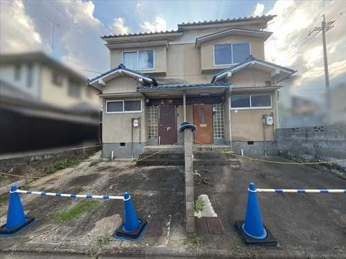
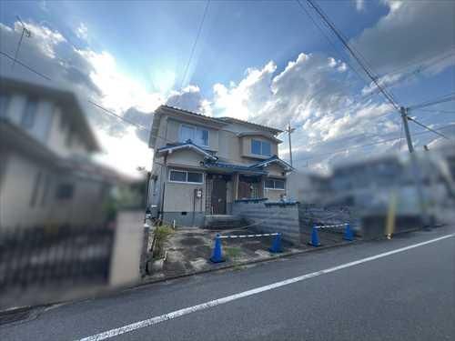
The current condition of the site includes an old house. The agent notes that they welcome inquiries from those who wish to actually see the property, and they encourage you to contact them freely regarding your preferred dates for a viewing.

Access to the property is available via public transport. It is approximately a 28-minute walk from Kitayama Station on the Kyoto Municipal Karasuma Line. Alternatively, bus access is possible: a 13-minute bus ride from Kitayama Station to the Kitakinobatacho bus stop followed by a 3-minute walk, or a 22-minute bus ride from Omiya Station on the Hankyu Kyoto Main Line to the Bukkyo University Mae bus stop, also followed by a 3-minute walk.

The land area is 123.1 square meters (approximately 37.23 tsubo). The property is zoned as Category I Low-Rise Exclusive Residential District, with a building coverage ratio of 60% and a floor area ratio of 100%. There are no specific building conditions attached to the land, and no notification under the National Land Use Planning Act is required. The land rights are ownership.

This description was AI-generated from the original Japanese listing and may contain inaccuracies. Please verify details with the source listing.

Summary

Land size: 123 / 1,325sqft

Short-Term Rental (Minpaku)

Transport

ITM

Osaka International Airport — 40 km away

Nearest Konbini

circle_k Circle K — 1 min walk

Internet Connectivity

Natural Hazard Assessment

Flood Risk Low Risk
Landslide Risk Moderate
Tsunami Risk Low Risk
Earthquake Hazard Moderate

Unlock hazard data with a free trial

Flood, landslide, tsunami & earthquake risk for this property

3 days free · cancel anytime

Start Free Trial

Purchase Cost & Tax Estimates

Agent fees, acquisition tax, registration costs & annual property tax

Airbnb Revenue Estimate

Projected nightly rate, occupancy & net income for this property

Investment ROI

Annual yield, break-even timeline & 10-year return projection

Map & Street View

Map loading...

Location Accuracy Notice: Although we try to make the map accurate with coordinates or address details provided, the location data is provided by the agent. This map data should be used as reference for the surrounding area foremost.

Location Type Beds Price Land House View

* Sold properties shown for price comparison only. Prices reflect historical sale data.

Location Type Beds Rent/Month Land House View

* Rental prices shown are monthly rates. Contact property owner for current availability.