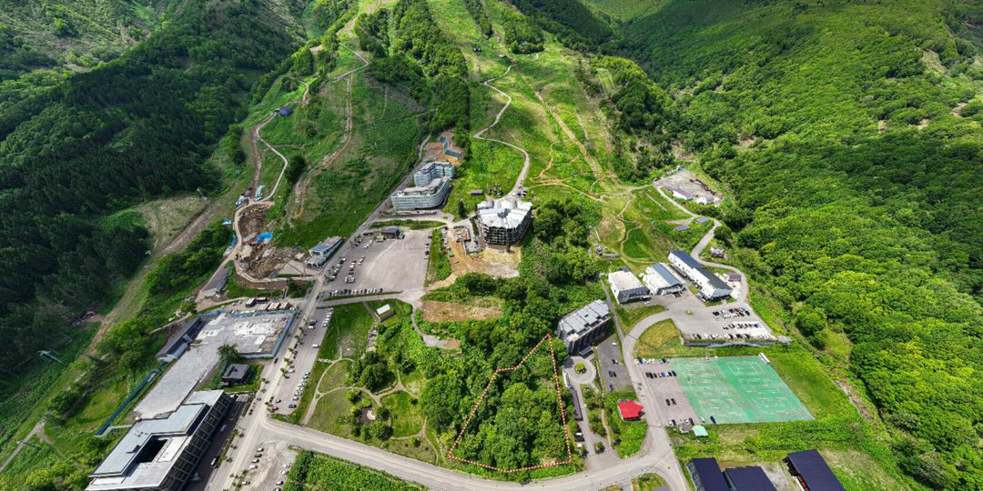
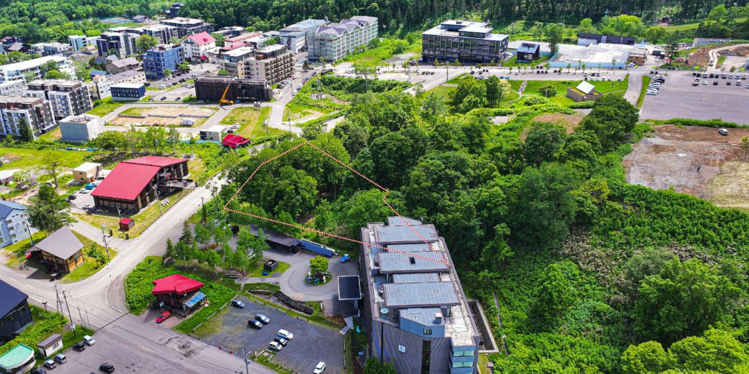
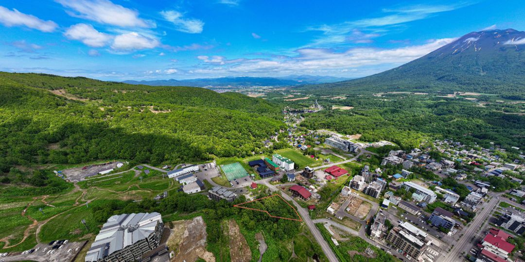
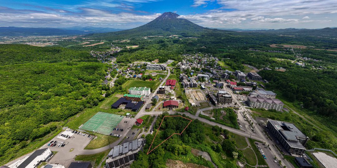
The Forest Upper Hirafu Development Land
This is an extremely rare land property, representing one of the few remaining development sites adjacent to a ski slope in Upper Hirafu. The property offers ski-in access directly from the ski resort. Located at a high elevation in Upper Hirafu, 'The Forest' is conveniently situated right next to a road, with Niseko's most famous ski equipment shop directly across the street. The land is adjacent to the Hirafu Gondola and Center Four lift stations (the latter currently being upgraded to a 10-person high-speed lift). The total land area is 3,827 square meters (over 1,150 tsubo). This medium-scale development land holds significant potential for future construction, such as an apartment hotel, and is near many famous ski-in/ski-out apartment hotels including Ki Niseko, Muwa Niseko, Sansui Niseko, and Skye Niseko. The property is located on a road named Koen Dori (meaning Park Road), adjacent to Sanso Park, making it an excellent location for cherry blossom viewing in spring and summer events. Such excellent undeveloped land properties in Hirafu are very rare.