Back to results Land for Sale in Nankoku City, Kochi – 475m2 Residential Lot
Added 3 days ago

Know someone who would love this? Gift them a subscription

¥28,488,000

626 Horinouchi, Nankoku City, Kochi Prefecture, Japan

高知県南国市堀ノ内626

Sign in to save properties

Buy Land Parking Rural Quiet Area

Unlock the full description with a free trial

Includes AI translation, hazard data, cost estimates & nearby amenities

3 days free · cancel anytime

Start Free Trial

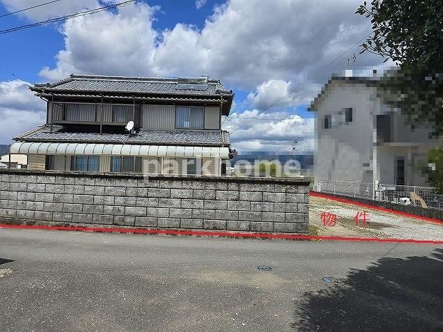
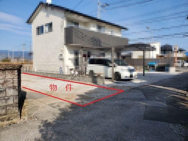
Land for Sale in Nankoku City, Kochi Prefecture

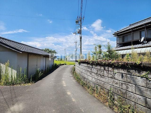
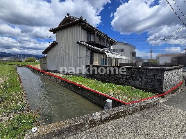
This is a residential building lot located in Horinouchi, Nankoku City, Kochi Prefecture. The land is being sold as a cleared, vacant lot (更地) with a surveyed area of 475.19 square meters (approximately 143.74 tsubo). The property faces a road on its south side, ensuring excellent sunlight exposure throughout the day. The lot is flat and level, making it suitable for construction.

The property has a building coverage ratio (建ぺい率) of 60% and a floor area ratio (容積率) of 200%. It is designated for residential use (宅地) within a urbanization control area (市街化調整区域). The land is serviced by public water supply (公営水道). Road access is from the south via a 2.7-meter-wide road (with a 4-meter road width). There is no private road maintenance obligation (私道負担無).

The surrounding area is quiet and rural, with rice fields and farmland nearby, offering a peaceful and rich natural environment. The nearest train station is Tosa-Nagaoka Station on the JR Dosan Line, approximately a 34-minute walk away. Gomenmachi Station on the Tosa Kuroshio Railway Asa Line is also accessible, about a 33-minute walk. A supermarket, Sunshine Caldia, is located approximately 3,626 meters away.

The asking price for this land is 28,488,000 yen. The property is being handled by Park Home Co., Ltd., a licensed real estate agent in Kochi Prefecture.

This description was AI-generated from the original Japanese listing and may contain inaccuracies. Please verify details with the source listing.

Summary

Land size: 475 / 5,115sqft

Short-Term Rental (Minpaku)

Transport

KIX

Kansai International Airport — 173 km away

Nearest Konbini

circle_k Circle K — 25 min walk

Internet Connectivity

Natural Hazard Assessment

Flood Risk Low Risk
Landslide Risk Moderate
Tsunami Risk Low Risk
Earthquake Hazard Moderate

Unlock hazard data with a free trial

Flood, landslide, tsunami & earthquake risk for this property

3 days free · cancel anytime

Start Free Trial

Purchase Cost & Tax Estimates

Agent fees, acquisition tax, registration costs & annual property tax

Airbnb Revenue Estimate

Projected nightly rate, occupancy & net income for this property

Investment ROI

Annual yield, break-even timeline & 10-year return projection

Map & Street View

Map loading...

Location Accuracy Notice: Although we try to make the map accurate with coordinates or address details provided, the location data is provided by the agent. This map data should be used as reference for the surrounding area foremost.

Location Type Beds Price Land House View

* Sold properties shown for price comparison only. Prices reflect historical sale data.

Location Type Beds Rent/Month Land House View

* Rental prices shown are monthly rates. Contact property owner for current availability.