Property Overview: Land in Kijimadaira Village
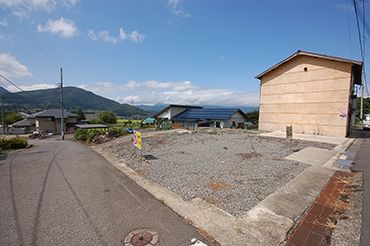
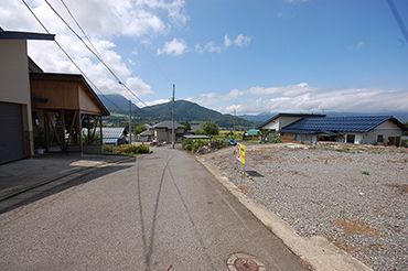
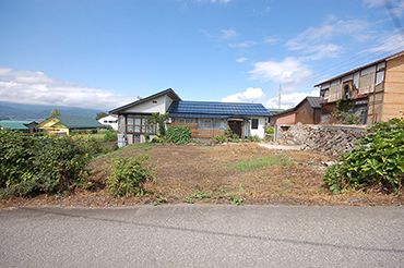
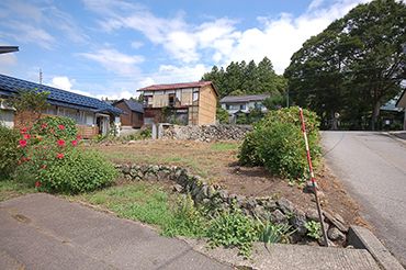
This is a plot of land located in Ogo, Kijimadaira Village, Shimotakai District, Nagano Prefecture. The property consists of two adjoining parcels: a former residential site (宅地) and an adjacent farm field (畑), with a total land area of 369.05 square meters (approximately 112 tsubo). The old house on the site has already been demolished and removed, making it ready for new construction or other uses.
The land is a corner plot facing a paved public road on the east side (approx. 5m width) and another paved road on the north side (approx. 4m width). The site is on a gentle slope (ひな壇地) and opens to the south, offering a view of Mount Kosha (高社山) and good sunlight. The upper section is the former residential area, while the lower section is the farm field; the two parcels have a height difference but are contiguous.
Utilities available include electricity, propane gas (PG), and public water and sewer (with separate connection fees and construction costs). The property is located in a village center area, with the village office, schools, a hospital, shops, a convenience store, a post office, and JA facilities all within approximately 2 km. The nearest elementary school is about 300 meters away, and the junior high school is about 1.6 km away. The property is about 7 km from Iiyama Station on the Hokuriku Shinkansen line and about 12 km from the Toyoda-Iiyama Interchange on the Joshinetsu Expressway.
The land has been surveyed under the national land survey (国土調査), with boundary markers already in place. The official survey results are expected around 2025, which may adjust the registered land area. The property is classified as residential land and farmland (with agricultural land regulations). The land is in the 'outside urban planning area' (区域外) category, with no specified building-to-land ratio or floor-area ratio. The current condition and delivery are negotiable (応相談), and the property is sold as-is (現況有姿渡し).