Back to results 2,056㎡ Vacant Land in Rikuzentakata, Iwate Prefecture

Verified Listing

This property was checked recently and confirmed to still be available. Tap for details.

Verified Listing

This property has been verified in the last month. Our system regularly checks listings to ensure they are still available.

Last verified: April 17, 2026

Know someone who would love this? Gift them a subscription

Contact Agent

Takata-cho Oishioki, Rikuzentakata City, Iwate Prefecture

岩手県 陸前高田市 高田町字大石沖

Sign in to save properties

Rent Land Akiya Bank Waterfront Quiet Area

Unlock the full description with a free trial

Includes AI translation, hazard data, cost estimates & nearby amenities

3 days free · cancel anytime

Start Free Trial

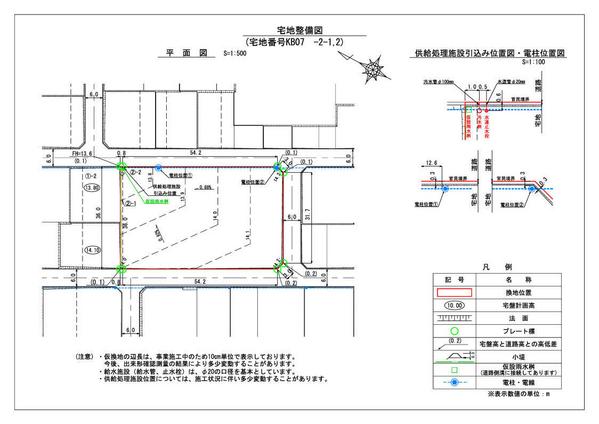
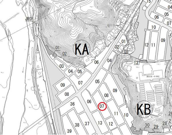
Located in Takata-cho, Rikuzentakata City, Iwate Prefecture, this vacant land property presents an excellent opportunity for development. The property is situated within an area currently undergoing land readjustment projects and is designated as a temporary replotting site (KB07 Block 2-1,-2).

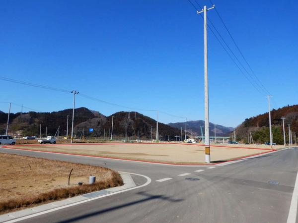
The spacious plot spans an impressive 2,056 square meters and is located in a Type 1 residential zone. With a building coverage ratio of 60% and a floor area ratio of 200%, this property offers significant development potential. The land is currently vacant and ready for construction.

Rikuzentakata City enjoys a relatively mild climate throughout the year due to its oceanfront location. The area has seen significant redevelopment following the 2011 tsunami, including the construction of seawalls and elevation of land. The famous 'Miracle Pine Tree' and the newly opened Takata-Matsubara Road Station have become local landmarks, contributing to the area's renewed vitality.

This description was AI-generated from the original Japanese listing and may contain inaccuracies. Please verify details with the source listing.

Summary

Land size: 2,056 / 22,131sqft

Short-Term Rental (Minpaku)

Transport

NRT

Narita International Airport — 377 km away

Nearby Konbini

Family Mart Family Mart — 18 min walk

Internet Connectivity

Natural Hazard Assessment

Flood Risk Low Risk
Landslide Risk Moderate
Tsunami Risk Low Risk
Earthquake Hazard Moderate

Unlock hazard data with a free trial

Flood, landslide, tsunami & earthquake risk for this property

3 days free · cancel anytime

Start Free Trial

Purchase Cost & Tax Estimates

Agent fees, acquisition tax, registration costs & annual property tax

Map & Street View

Map loading...

Location Accuracy Notice: Although we try to make the map accurate with coordinates or address details provided, the location data is provided by the agent. This map data should be used as reference for the surrounding area foremost.

Location Type Beds Price Land House View

* Sold properties shown for price comparison only. Prices reflect historical sale data.

Location Type Beds Rent/Month Land House View

* Rental prices shown are monthly rates. Contact property owner for current availability.