Back to results Vacant Land for Sale in Sakyo Ward, Kyoto - 118.57 sqm

Verified Listing

This property was checked recently and confirmed to still be available. Tap for details.

Verified Listing

This property has been verified in the last month. Our system regularly checks listings to ensure they are still available.

Last verified: April 21, 2026

Know someone who would love this? Gift them a subscription

¥46,800,000

Kita-Shirakawa Kami-Ikeda-cho, Sakyo Ward, Kyoto City, Kyoto Prefecture

京都府京都市左京区北白川上池田町

Sign in to save properties

Buy Near Station Land Suburban Quiet Area

Unlock the full description with a free trial

Includes AI translation, hazard data, cost estimates & nearby amenities

3 days free · cancel anytime

Start Free Trial

Land for Sale in Kyoto's Left Bank District

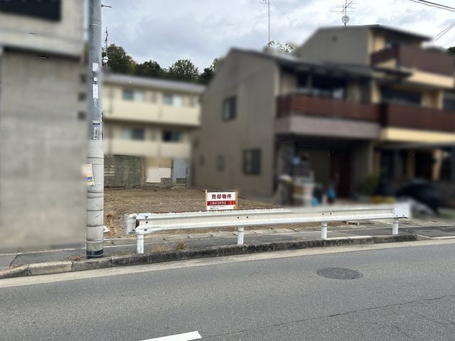
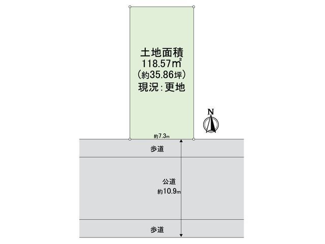
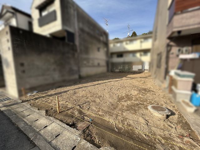
This vacant land plot is located in the Kita-Shirakawa Kami-Ikeda-cho area of Sakyo Ward, Kyoto. The property is a relatively well-shaped plot with a total land area of 118.57 square meters (35.86 tsubo). It faces south, ensuring good sunlight exposure. The land is not sold with any building conditions attached, meaning the buyer is free to choose their preferred house builder or contractor for construction.

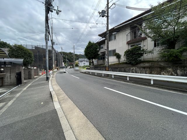
The property is situated in a residential area with convenient access to daily amenities. A bus stop is within a 3-minute walk. The nearest station is Demachiyanagi Station on the Keihan Main Line, which is a 9-minute bus ride plus a 2-minute walk from the bus stop. Nearby facilities include Fresco Kita-Shirakawa supermarket (a 6-minute walk, 450m), FamilyMart Shirakawa-dori Betsuto-cho convenience store (a 5-minute walk, 350m), and Kita-Shirakawa Post Office (a 9-minute walk, 650m). Kita-Shirakawa Elementary School is a short 4-minute walk (270m) away.

According to the agent's special notes, the current condition of the property is vacant land. The agent encourages interested parties to feel free to inquire if they wish to see the property in person, and to provide their preferred dates for a viewing.

The land is zoned as Category I Medium-to-High-Rise Exclusive Residential Area. The building-to-land ratio is 60% and the floor area ratio is 200%. The property fronts a public road to the south with a frontage of 7.3 meters. Utilities include public water supply and city gas. The land rights are freehold (ownership).

This description was AI-generated from the original Japanese listing and may contain inaccuracies. Please verify details with the source listing.

Summary

Land size: 119 / 1,276sqft

Short-Term Rental (Minpaku)

Transport

ITM

Osaka International Airport — 43 km away

Nearest Konbini

family_mart Family Mart — 3 min walk

Internet Connectivity

Natural Hazard Assessment

Flood Risk Low Risk
Landslide Risk Moderate
Tsunami Risk Low Risk
Earthquake Hazard Moderate

Unlock hazard data with a free trial

Flood, landslide, tsunami & earthquake risk for this property

3 days free · cancel anytime

Start Free Trial

Purchase Cost & Tax Estimates

Agent fees, acquisition tax, registration costs & annual property tax

Airbnb Revenue Estimate

Projected nightly rate, occupancy & net income for this property

Investment ROI

Annual yield, break-even timeline & 10-year return projection

Map & Street View

Map loading...

Location Accuracy Notice: Although we try to make the map accurate with coordinates or address details provided, the location data is provided by the agent. This map data should be used as reference for the surrounding area foremost.

Location Type Beds Price Land House View

* Sold properties shown for price comparison only. Prices reflect historical sale data.

Location Type Beds Rent/Month Land House View

* Rental prices shown are monthly rates. Contact property owner for current availability.