Back to results Vacant Land Plot in Takata-cho, Rikuzentakata - 199m² Development Site

Verified Listing

This property was checked recently and confirmed to still be available. Tap for details.

Verified Listing

This property has been verified in the last month. Our system regularly checks listings to ensure they are still available.

Last verified: April 28, 2026

Know someone who would love this? Gift them a subscription

Negotiable

Takata-cho Oishioki, Rikuzentakata City, Iwate Prefecture

岩手県 陸前高田市 高田町字大石沖

Sign in to save properties

Buy Seaside Property Near Station Land Akiya Bank Quiet Area

Unlock the full description with a free trial

Includes AI translation, hazard data, cost estimates & nearby amenities

3 days free · cancel anytime

Start Free Trial

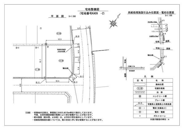
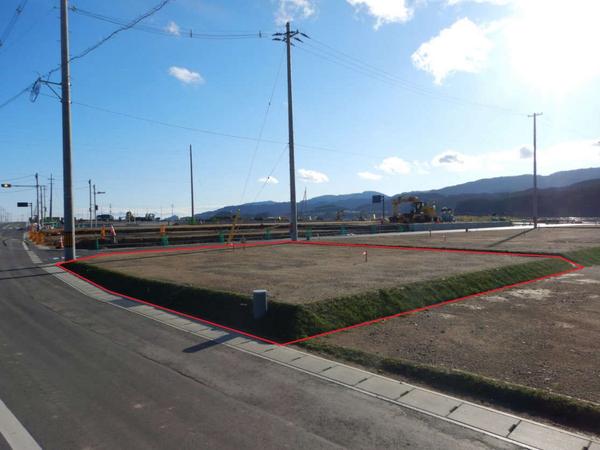
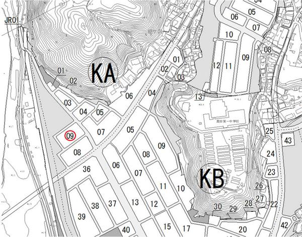
Located in Takata-cho, Rikuzentakata City, Iwate Prefecture, this vacant land property offers an excellent opportunity for development. The lot measures 199 square meters and is situated in a Type 1 residential zone. Currently undergoing land readjustment, this plot is designated as a temporary reallocation site in the KA09 block (sections 3,4-1,4-2,5).

The property benefits from its proximity to the Rikuzentakata Station on the JR Ofunato Line (BRT), providing convenient transportation links. The area enjoys a relatively mild climate throughout the year due to its coastal location and geographical conditions.

Rikuzentakata City has been actively rebuilding since the Great East Japan Earthquake, with ongoing improvements including seawall construction, land elevation, and relocation of urban facilities. The nearby Miracle Pine and Takata-Matsubara Road Station have become new attractions, bringing vitality to the area.

This description was AI-generated from the original Japanese listing and may contain inaccuracies. Please verify details with the source listing.

Summary

Land size: 199 / 2,142sqft

Short-Term Rental (Minpaku)

Transport

NRT

Narita International Airport — 377 km away

Nearby Konbini

Family Mart Family Mart — 18 min walk

Internet Connectivity

Natural Hazard Assessment

Flood Risk Low Risk
Landslide Risk Moderate
Tsunami Risk Low Risk
Earthquake Hazard Moderate

Unlock hazard data with a free trial

Flood, landslide, tsunami & earthquake risk for this property

3 days free · cancel anytime

Start Free Trial

Purchase Cost & Tax Estimates

Agent fees, acquisition tax, registration costs & annual property tax

Map & Street View

Map loading...

Location Accuracy Notice: Although we try to make the map accurate with coordinates or address details provided, the location data is provided by the agent. This map data should be used as reference for the surrounding area foremost.

Location Type Beds Price Land House View

* Sold properties shown for price comparison only. Prices reflect historical sale data.

Location Type Beds Rent/Month Land House View

* Rental prices shown are monthly rates. Contact property owner for current availability.