
The Data Gap That Most Buyers Walk Into
Japan has 9.375 million vacant homes — 13.8% of all residential housing stock, a record set in the October 2023 survey published by the Ministry of Land, Infrastructure, Transport and Tourism (MLIT). The country adds roughly 500,000 more vacant properties every five years. For international buyers, this sounds like opportunity. What the headline doesn't tell you is that Japan simultaneously has one of the most sophisticated and fragmented property data systems in the developed world.
Most foreign buyers approach the Japanese market the way they would approach a search in their home country: find a listing, look at photos, contact an agent. That works well enough in markets where information is centralised and transparent. In Japan, it leaves you operating on a fraction of the available intelligence. The buyers who get the best deals — the right property at the right price in a location that holds or appreciates in value — are working multiple data layers simultaneously.
This guide maps those data layers. It covers the government databases that most international buyers never discover, how to read the akiya bank (空き家バンク / akiya banku) system more strategically, how to layer hazard data onto your target search area, and how to model the true cost of ownership before you make a single enquiry. None of this requires Japanese language fluency, though even basic machine translation opens up databases that English-language resources rarely mention.
Japan's Five Core Property Data Sources
1. The Real Property Information Library (不動産情報ライブラリ / Fudōsan Jōhō Raiburarī)
Launched in April 2024 by MLIT, the Real Property Information Library at reinfolib.mlit.go.jp is the most significant development in Japanese property data transparency in decades. It consolidates approximately 5.47 million real estate transaction records — covering land, land with buildings, and condominiums — into a single WebGIS map interface, alongside land pricing data, disaster prevention overlays, and urban planning information.
The interface operates like a layered map: zoom into any area of Japan, click on transaction data, and see actual sale prices going back to Q3 2005. The database is free, requires no registration, and has a public API available to developers who apply for access. This is the closest thing Japan has to a publicly accessible sale price history for any given neighbourhood.
What to look for: when evaluating a target municipality, pull the last 20–30 land transactions within a 5-kilometre radius of your area of interest. Pay attention to the relationship between land price per square metre and property type. If vacant land is transacting at ¥10,000–¥30,000 per square metre while akiya banks in the same area ask ¥2,000,000–¥5,000,000 for a house with land, you have a data-backed basis for negotiation — or for identifying which akiya listings are overpriced relative to underlying land value.
2. The National Land Price Map (全国地価マップ / Zenkoku Chika Mappu)
The National Land Price Map at chikamap.jp provides four types of valuation data in one interface: the published land price (公示地価 / kōji chika), the prefectural land price survey (基準地価 / kijun chika), the inheritance tax road price (相続税路線価 / sōzokuzei rosen-ka), and the fixed asset tax road price (固定資産税路線価 / koteishisanzei rosen-ka).
For buyers, the most actionable figures are the published land price and the inheritance tax road price. The published land price reflects government-assessed market value; the inheritance tax road price is set at approximately 80% of that. These figures reveal how official Japan views the underlying land value — and how far removed any asking price might be from it.
National context as of 2026: the average public notice land price nationwide is ¥298,372/m². The five most expensive prefectures by average price are Tokyo (¥1,484,765/m²), Osaka (¥412,022/m²), Kyoto (¥362,311/m²), Kanagawa (¥322,476/m²), and Fukuoka (¥263,636/m²). The national year-on-year change rate is +2.80% — the market is not declining on average, which matters for buyers treating akiya as an investment rather than a lifestyle purchase.
3. The Japan Property Price Index (不動産価格指数 / Fudōsan Kakaku Shisū)
For macro context, MLIT publishes the Property Price Index covering both residential and commercial property. The residential index is updated monthly using approximately 300,000 transaction records annually. The most recent reading put the nationwide residential index at 144.1 on a 2015 baseline — representing a 44% real increase over a decade. This index matters when evaluating whether a regional market is rising or contracting relative to the national trend. A prefecture showing strong index growth is a different investment proposition from one tracking flat or declining relative to Tokyo.
4. The REINS Database — Through a Licensed Agent
Japan's official Multiple Listing System — the Real Estate Information Network System, or REINS (レインズ) — is not public. Access requires a licensed broker. Understanding what it contains, however, changes how you work with agents. REINS holds comprehensive current and recent listings from licensed brokers nationwide, including properties that never appear on public consumer portals.
When you engage a Japanese real estate agent, asking them to run specific REINS queries — filtered by area, price band, structure type, construction date, and land size — is a fundamentally different request than asking them to "show you what's available." The former treats the agent as a data resource with a professional tool. The latter leaves the selection to them. For buyers who have done the data work described in this guide, the REINS request can be specific enough to produce a targeted shortlist rather than a tour of whatever is easy to show.
5. The Legal Affairs Bureau Land Registry (法務局 / Hōmushoku)
Before any purchase, the land registry maintained by the Legal Affairs Bureau (法務局 / hōmushoku) should be consulted. The registry certificate — formally the 登記事項証明書 (tōki jikō shōmeisho) — records the current owner, ownership history, liens, mortgages, and any encumbrances on the property. In Japan, approximately 30% of akiya properties have unclear or disputed ownership, typically because title was never formally transferred after an inheritance. Consulting the registry before serious negotiation is not optional — it is the first verification step that separates professional buyers from those who skip due diligence.
Registry certificates can be obtained in person at any Legal Affairs Bureau office for a small fee (typically ¥480 per document), or via Japan's online registry system for ¥331 per document. A licensed judicial scrivener (司法書士 / shihō shoshi) can conduct this research on your behalf as part of the purchase process.
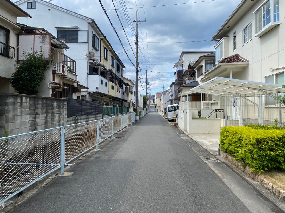
Japan's residential neighbourhoods span every context — urban, suburban, coastal, and rural. The data behind each location looks very different once you know where to look. Photo: Pexels
The Akiya Bank Ecosystem — Reading Past the Surface
Over 1,000 Japanese municipalities operate akiya banks (空き家バンク / akiya banku) — formal registries of vacant properties available for purchase or rental. These range from prefectural-scale operations to small town offices with five listings updated quarterly. Understanding how the ecosystem actually works changes where you search for properties and how you approach the ones you find.
National Aggregators vs. Municipal Banks
MLIT has designated two national aggregation platforms — LIFULL HOME'S Akiya Bank and At Home Akiya Bank — which pull listings from participating municipalities into searchable, relatively accessible formats. These national portals are a useful starting point. They are not the complete picture.
Participation is voluntary. Many municipalities — particularly smaller towns with the highest vacancy rates — operate independent akiya banks on their city office websites and never sync those listings to the national platforms. The municipality with 200 cheap vacant properties and a renovation subsidy program may not appear on LIFULL HOME'S at all. Checking both national platforms and individual municipal websites is the research requirement, not the optional extra.
The most comprehensive English-language directory of municipal akiya banks is at akiyabanks.com, which maintains alphabetical listings of every municipal program with direct links to individual city portals. Cross-referencing this against your target prefectures reveals programs that the major aggregators miss.
What Akiya Bank Listings Don't Include
Municipal akiya bank listings are not managed like real estate agency listings. Photographs may be years old. Prices may not reflect a competitive market assessment. The property condition rating — usually described in one of three tiers — is often self-reported by the seller or the municipal coordinator. "Requires renovation" (要修繕 / yō shūzen) can mean anything from a fresh coat of paint to structural defects that make the building uninhabitable without substantial investment.
Contact the municipal coordinator directly. Most municipalities have a dedicated officer (担当 / tantō) responsible for akiya coordination, and direct enquiry often surfaces properties that have been reserved but where a transaction fell through, recent additions not yet updated online, or additional details about the property's history that the formal listing omits. Many of the best akiya deals circulate informally before they appear publicly — and a direct relationship with the municipal office puts you in that information flow.

Residential hillside in Kyoto — where properties in desirable neighbourhoods command very different prices than the prefecture-level averages suggest. Photo: Unsplash
Layering Hazard Data — The Risk Layer Most Buyers Skip
Japan sits at the intersection of four tectonic plates and accounts for roughly 20% of the world's highest-magnitude earthquakes. Every property purchase in Japan carries some environmental risk; the question is how much, and whether the price reflects it. The government publishes extensive hazard data that is free, publicly accessible, and almost entirely overlooked by international buyers focused on photos and price.
Flood Hazard Maps (洪水ハザードマップ / Kōzui Hazado Mappu)
Every municipality in Japan is required to publish flood hazard maps showing predicted inundation depths for 50-year, 100-year, and 1,000-year rainfall events. Properties in high-flood-risk zones are legally required to disclose this risk at point of sale — but understanding that risk before you reach the negotiation stage is significantly better. The Japan Meteorological Agency's real-time risk map at jma.go.jp/bosai/en_risk provides a current-conditions view; historical flood risk maps are accessible through your target municipality's disaster prevention (防災 / bōsai) page or via MLIT's Hazard Station portal.
Practical implication: a property priced at ¥1,500,000 in a Level 3 flood risk zone is not the bargain it initially appears. Flood insurance in Japan for high-risk zones is expensive where available at all, post-flood renovation is costly, and resale in a zone with documented flood history is difficult. The same price point in a lower-risk area of the same prefecture may represent genuine value. The maps make this comparison possible before you visit anything.
Earthquake and Liquefaction Risk
The National Research Institute for Earth Science and Disaster Resilience publishes the Japan Seismic Hazard Map, which shows expected ground shaking intensity by area over 30- and 50-year horizons. Separately, municipal liquefaction risk maps (液状化ハザードマップ / ekijōka hazado mappu) indicate where soil is likely to liquefy in a major seismic event — a critical factor for properties on reclaimed land, near rivers, or in coastal areas.
For buyers looking at properties in the Tokyo metropolitan area, four distinct hazard layers apply simultaneously: earthquake shaking, liquefaction potential, river and inland flooding, and tsunami or storm surge risk. A property in eastern Tokyo's Kōtō Ward may score well on one dimension and poorly on three others. No single number captures total risk — these maps need to be read together as a composite.
Pre-2000 vs. Post-2000 Construction
Japan's seismic building codes were substantially revised in 1981 and again in 2000. Properties built before 1981 are constructed to pre-modern standards; properties built between 1981 and 1999 meet the revised code but not the 2000 update. Post-2000 construction in Japan is held to one of the most rigorous seismic standards in the world.
For akiya buyers, the construction date on any listing is not just an age indicator — it is a seismic risk signal. Pre-1981 properties can be earthquake-retrofitted (耐震補強 / taishin hokyō), and some municipalities offer subsidies for doing so, but costs typically run ¥500,000–¥2,000,000 depending on the structure. This cost should be factored into total acquisition modelling before you compare listings side by side.
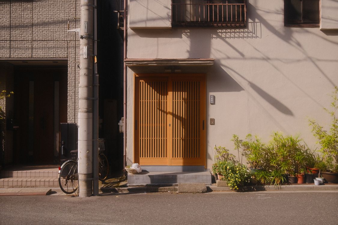
Traditional wooden lattice entrance on a Tokyo residential street — older structures require seismic risk assessment as part of the research process. Photo: Pexels
Fixed Asset Tax as a Valuation Data Layer
Japan's fixed asset tax (固定資産税 / koteishisanzei) — levied at 1.4% of assessed value annually, plus a 0.3% city planning tax (都市計画税 / toshi keikaku zei) in designated urban areas — is not just an ongoing cost. It contains information that sophisticated buyers use as a second valuation reference.
Because the assessed value is a matter of public record and is conducted independently of the market, it creates a government-sourced floor for what the underlying land is worth. Here is the practical application: a property listed at ¥3,000,000 in a rural municipality will have an official assessed value for both the land and the structure. If the annual fixed asset tax notice shows a combined annual tax of ¥14,000, you can estimate the assessed value at approximately ¥1,000,000 (¥14,000 ÷ 1.4%). That official assessment is based on roughly 70% of the government's published land price. Backing out the implied land value from the tax data gives you a government-derived floor for what the land is worth.
When an asking price is materially higher than what tax data implies, the gap requires justification — a particular location advantage, structural improvements, or an optimistic seller. When the asking price is below the implied land value, you may be looking at a genuinely distressed sale where the seller's priority is exit, not price. Tax notices are typically shared during due diligence; request them early and use them actively.
Payment is due in four annual instalments — June, September, December, and February — and the annual amount tends to be modest on lower-value rural properties (¥10,000–¥50,000 per year is common for akiya in non-urban areas). Factor this into your total cost of ownership modelling alongside renovation estimates.
The Subsidy Stack: Reducing Your Net Acquisition Cost
Japan operates multiple overlapping financial incentive programs for buyers who relocate from urban areas or renovate vacant properties. These programs are not widely publicised to international audiences, but many are accessible to foreign nationals who hold appropriate residency status and meet the criteria.
The Regional Migration Support Grant (地方創生移住支援事業 / Chihō Sōsei Ijū Shien Jigyō)
The Cabinet Office's primary relocation incentive covers 44 of Japan's 47 prefectures as a destination (excluding Tokyo, Osaka Prefecture, Kanagawa, and Okinawa as origin points). Eligible applicants — those relocating from central Tokyo's 23 wards or specified Greater Tokyo commuter zones — can receive:
- Individual relocation grant: ¥1,000,000
- Business startup bonus: ¥2,000,000 additional
- Child bonus (from April 2023): ¥1,000,000 per child
A family of three relocating from central Tokyo to a qualifying prefecture and starting a small local business could therefore be eligible for up to ¥5,000,000 in national-level support — before any municipal programs are applied. Eligibility conditions include having lived or worked in a qualifying area for at least five of the past ten years, and committing to reside in the destination for a minimum of five years.
Municipal Renovation Subsidies
Independently of the national program, most municipalities with akiya banks operate renovation subsidy programs covering 30%–50% of eligible renovation costs, typically capped at ¥1,000,000–¥5,000,000. These programs prioritise buyers intending to make the property their primary residence. Documentation requirements vary; most municipalities require quotes from local contractors and a renovation plan submitted before work begins.
Some municipalities go further: free property transfers (¥0 purchase price), subsidised utility reconnection for properties that have been disconnected for years, and seismic retrofit subsidies that can cover ¥500,000–¥1,000,000 of the structural work. The detail lives in individual municipal akiya bank programme guidelines — which is one more reason why direct contact with municipal coordinators, not just portal browsing, produces better outcomes for serious buyers.
Combining a low akiya purchase price with a national relocation grant, a municipal renovation subsidy, and seismic retrofit support can reduce the all-in cost of an acquisition to a figure that a Western property buyer would consider implausible. The programs exist. The data is accessible. But you have to know where to find it and ask for it specifically.
Your Five-Step Research Protocol
Combining these data sources into a replicable workflow transforms a property search from browsing into structured intelligence gathering. The following protocol applies to any target area in Japan:
- Establish the regional price baseline. Use chikamap.jp to pull the current published land price and fixed asset tax road price for your target area. This gives you a government-derived floor valuation before you look at a single listing.
- Review comparable transactions. Use reinfolib.mlit.go.jp to pull recent sales within your target radius — ideally the last 30–50 transactions within 5 kilometres. Note the distribution of prices per square metre for both land and built properties. This tells you what the market has actually cleared, not what sellers are currently asking.
- Map the hazard profile. Pull the flood, earthquake, and liquefaction maps for your target municipality before looking at specific addresses. Eliminate any zones where risk exceeds your tolerance before spending time on property-specific research. This step is non-negotiable.
- Identify all active akiya banks. Use akiyabanks.com to find every municipal program within your target prefecture. Check both the national aggregators and each local municipal page directly. Contact the municipal coordinator for any area you are seriously considering.
- Stack the subsidy calculation. Before finalising a target municipality, calculate your total subsidy eligibility: national relocation grant (if applicable), municipal renovation subsidy, seismic retrofit support (if pre-2000 construction), and any utility reconnection assistance. This converts an asking price into a net acquisition cost — and that number is often very different from the headline price.
The total time investment for this protocol, before enquiring about any specific property, is approximately five to eight hours of research. That upfront work routinely surfaces information that changes the shortlist of viable candidates, and occasionally reveals that the property everyone knows about is less interesting than a listing from an obscure municipality that no competitor has found.
Using Akiya Japan's Tools Within This Framework
Akiya Japan aggregates listings from across Japan into a single searchable platform — covering buy, rent, akiya bank, and new-build categories — spanning urban apartments, suburban houses, coastal properties, and rural land, across all 47 prefectures. The database pulls from sources that most international buyers would never encounter individually: municipal akiya banks, regional agents, direct seller listings, and government land sales.
The map-based search interface lets you apply geographic filters that align directly with the data layers described above: target a specific prefecture, draw a bounding box around a municipality you've researched, filter by price band and property type, and set up alerts for new listings in that area. Rather than repeatedly checking dozens of sources, you can use a saved search as a monitoring layer that runs continuously while you work through the offline research steps.
For buyers who have moved from database research into serious purchase consideration — running land registry checks, assessing a specific property's hazard profile, and calculating renovation and subsidy scenarios — the legal and transactional complexity of Japanese property benefits from local professional support. Teritoru, our licensed Japanese real estate brokerage partner, specialises in supporting foreign buyers through the full purchase process in English. Founder Ai Hioki and the Teritoru team provide guidance from property evaluation through title transfer, including ownership verification, contract review, and post-purchase registration. For buyers working through the complexity of pre-1981 structures, unclear inheritance chains, or unfamiliar regional markets, professional guidance represents a fraction of the cost of a transaction that goes wrong. Book an initial consultation with Teritoru to discuss your target area and current research before entering any negotiation.
What the Data Cannot Tell You
This guide has focused on the data available before visiting a property. One final point on its limits: no database records the actual state of a building's structural members, underground plumbing, or roof history. No map shows whether the neighbours maintain their property or how a community responds to newcomers. No government index captures the particular character of a town in a way that tells you whether you will actually want to live there.
Data-driven property research in Japan narrows the field from 9 million vacant homes to a shortlist of serious candidates. It eliminates properties with irrecoverable hazard profiles, identifies where the subsidy stack makes financial sense, and provides factual leverage in negotiations. Everything after that requires visiting, asking, observing, and ultimately making a judgement that no database can make for you.
The buyers who do the data work before they do the site visits are the ones who know exactly what question to ask when they arrive — and who recognise a good answer when they hear it.
Sources
- Real Property Information Library — Ministry of Land, Infrastructure, Transport and Tourism (MLIT)
- National Land Price Map (全国地価マップ) — MLIT
- Japan Property Price Index (不動産価格指数) — MLIT
- Akiya Banks Directory — akiyabanks.com
- Number of Vacant Homes in Japan Reaches Record 9 Million — Nippon.com
- Real Property Registration — Ministry of Justice Legal Affairs Bureau
- Japan Meteorological Agency Real-time Disaster Risk Map
- How to Qualify for Subsidies to Move from Tokyo to the Japanese Countryside — realestate.co.jp
- Vacancy Rate of Housing Units in Japan 1963–2023 — Statista

